
Ballparks: ‘Wally’ Green, Hartford Yard Goats, Beehive Buzz, Muzzy Field.
“Every day is a new opportunity. You can build on yesterday’s success or put its failures behind and start over again. That’s the way life is, with a new game every day, and that’s the way baseball is.” – Bob Feller
It’s not necessary to speak baseball to have a good time at a ballpark. An outing to a stadium is an experience, entertaining, a memory maker. Have a hot dog, revel in what makes each arena of play unique. Watch the people. On a summer day or evening when the sun goes down and the lights come up, there’s something magic that happens. You may get swept up in the spectacle and catch the fever. Or maybe not. But for the best experience, go with a diehard fan.
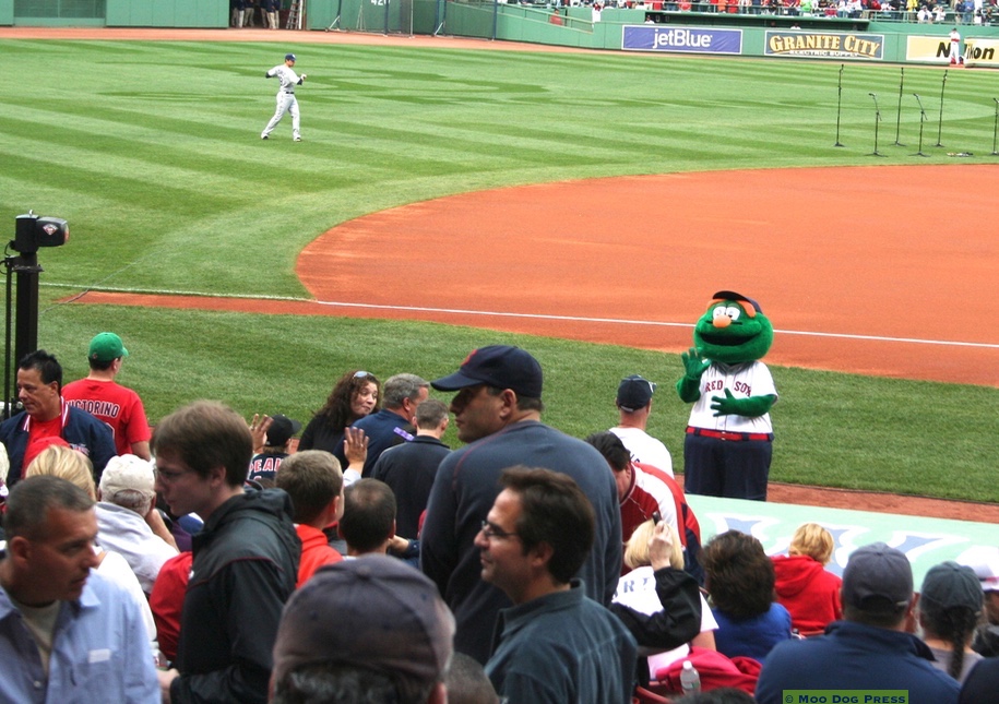
‘Wally’ at Fenway Park. Here’s green for the “Green Monster” – get it? Mascots are fun, get the crowd going – part of the overall entertainment. MDP file photo.
Have tickets, go one way. Need tickets? Step right this way. There’s bustling hubbub of happy humanity outside where a game will be played. Crowds mill about, banners flutter, there’s excitement and anticipation in the air.
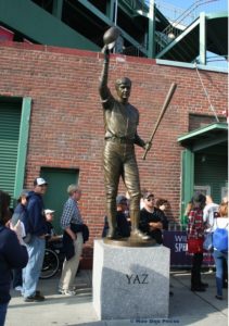
Yaz.
Weather is a factor. Sunshine, bring a hat. Rain delays, be patient. And there’s a story everywhere in the legendary Major League Baseball (MLB) parks. Smaller parks hold history, too.
At Fenway, a statue of Hall of Famer Carl Yastrzemski – “Yaz” as he tips his cap. The figure stands head and shoulders above passersby. Enter the stadium, inhale and watch your step. Aromas waft by, combining good food smells (hot dogs!), a whiff of some kind of cleaner, the undercurrent of something else that’s aromatic. Definitely want that hot dog with mustard and ketchup. Maybe….a pretzel? No, that can wait, let’s go look around.
Inside and up the ramp, so much to see. Retired numbers of legendary players on display. “Pesky’s Pole” – that’s the right field foul pole at Fenway named for Johnny Pesky.
Then there’s that one red seat. All sorts of reminders and memorials of those who have gone before – a storied past.
Another day, a business visit meant sitting in the press box at Fenway Park, a lifetime memory. The goal? Capture an interview about the business aspects of Major League Baseball. Marketing, customer relations, creative ideas, coming up with something new, better, always. The view of the greener-than-green field and the working reporters had to be tuned out. The focus of how it all works together – promotions, human relations, merchandising to make the best experience for the fans.
A photo shoot at Yankee Stadium – the old Yankee Stadium – where stepping inside felt like being transported to another era. Another amazing experience, especially going up to the main office and the conversation that took place between the photographer, his assistant, the editor, a seasoned sports writer. What a crew. What a day. The look on the face of the writer when he stepped onto the field where his heroes had stood and played – all the emotions intermingled right there on his face. It was pretty quiet in the Town Car on the ride back to the office.
But that’s all in the past. At present, it’s full-throated summer 2017. What’s new?
The Hartford Yard Goats at the brand-new Dunkin’ Donuts Park is a summer draw for crowds – opened in 2017, it’s good for the city, good for the neighbors and area businesses.
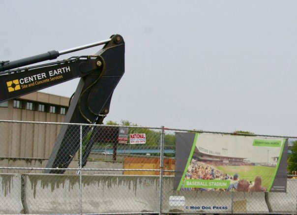
When it was a dream being built into reality – the Dunkin’ Donuts Stadium in Hartford.
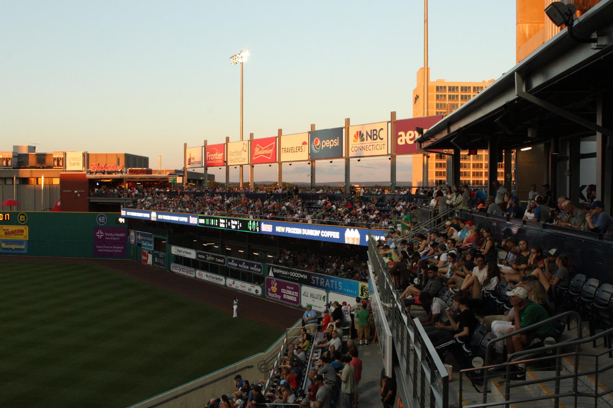
And now – crowds throng to games. Hartford Yard Goats image, linked to the FB page.
“Dunkin’ Donuts Park is a 6,056-seat baseball park in Hartford, Connecticut. It hosts the Hartford Yard Goats, the AA Affiliate of the Colorado Rockies…. The stadium opened in time for the team’s 2017 home opener on April 13. Dunkin’ Donuts purchased the naming rights for the stadium for an undisclosed amount. The ballpark is part of a larger $400-million redevelopment plan called Downtown North (DoNo).” – Wikipedia
Not too far away, due west, is the home of the New Britain Bees, a member of the Atlantic League of Professional Baseball (not affiliated with MLB). The team succeeds the New Britain Rock Cats, the team that played in the Eastern League before moving to Dunkin’ Donuts Park for the 2016 season, and becoming the Hartford Yard Goats.
“The ‘Bees’ name alludes to Beehive Field, an older baseball park which stands next to New Britain Stadium. The civic motto of New Britain – ‘Industry fills the hive and enjoys the honey.’ Additionally, the civic emblem and flag incorporate a beehive as a symbol of industriousness. New Britain’s official nickname is the ‘Hardware City,’ referring to its industrial heritage – namely as the headquarters of Stanley Black & Decker.” – Wikipedia
Collected.
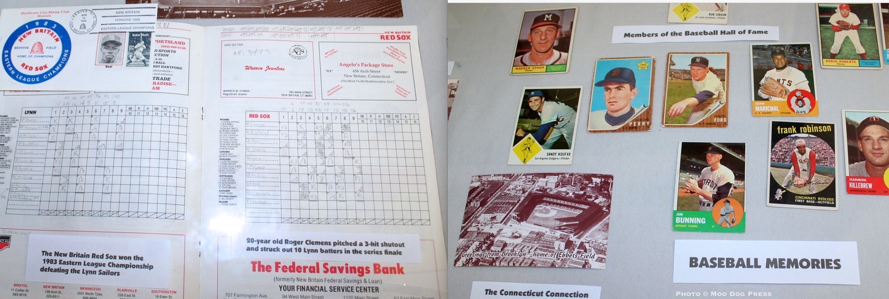
Then there is Muzzy Field in Bristol.
According to the Bristol Sports Hall of Fame, Adrian Muzzy was a “local businessman who donated the property we now know as Muzzy Field to the Public Welfare Association in Bristol in 1912. The Public Welfare Association, in turn, gave the land to the City of Bristol, which turned it into one of New England’s most historic and beautiful ball parks. Babe Ruth played at the park twice and was the first to hit a home run over the fence in a game, an exhibition in 1919 when he was playing for the Boston Red Sox.
“A number of other well-known sports figures have played on the field, including the great NFL coach Vince Lombardi and baseball hall of famers Pie Traynor, Lloyd Waner, Honus Wagner, Wade Boggs, Ryne Sandberg and Gary Carter as well as thousands of local athletes in a variety of sports.
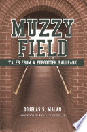
A book about Muzzy Field.
“Muzzy donated the property in memory of two sons who died at very young ages. Those who have played on the field will tell you it’s an honor because of those who played on it before them. Adrian Muzzy’s gift has long been and will continue to be one of Bristol’s greatest treasures.”
See what I mean about human stories? Out of deep sadness a man decides to move forward and do something for others – and that becomes a place of respect, a playing field with honor.
Bristol Sports Hall of Fame is located in the Bristol Historical Society (originally the high school), 98 Summer St. and also at the Dennis Malone Aquatic Center. Here’s a link to their official site with scrapbooks of other sports notables.
There’s a book too. Muzzy Field: Tales from a Forgotten Ballpark by Douglas S. Malan (2009, iUniverse).
“Few ballparks still in use today can boast of hosting both Babe Ruth and Vince Lombardi during their playing days. Muzzy Field in Bristol, Connecticut, is one of them…
Tucked away in the woodsy corner of a public park located within the once-gilded boundaries of a manufacturing city, Muzzy Field’s illustrious history began as a charitable land donation in 1912. With the financial backing of the sports-minded management at New Departure Manufacturing, the field became home to one of the area’s strongest semi-professional baseball teams; it also welcomed some of the greatest athletes who played the game from Ruth to Martín Dihigo and dozens of Hall of Fame athletes.”
So manufacturing history is woven into the stories of the field as well. (That brings to mind a field trip of another day, and part one of the related story here.)
Then there are those who dream of seeing every MLB park in the U.S. – Big League Tours, “we provide the ultimate baseball road trip; great seats, great hotels, great times” is an official partner of MLB. Your bucket list wish can be fulfilled. Or those with a yen can do a self-directed road trip and stop at the smaller parks as well.
Here’s the thing about baseball. It’s civilized, yet passionately played. It’s a game that takes intelligence, strategy, prime athletes, and wise management. There are endless variations, always something more to learn – and the storied history of the game and its players.
“Baseball is almost the only orderly thing in a very unorderly world. If you get three strikes, even the best lawyer in the world can’t get you off.” – Bill Veeck