
2020 Open Space And Watershed DEEP Grants
Open Space And Time In Connecticut, 24 Communities, 2,466 Acres continued from previous page
Middletown, Lamentation Mountain/Tighe-Baldyga Property Acquisition; sponsor is Berlin Land Trust, Inc., $63,450. Total area, 47 acres. Located at the north end of Lamentation Mountain in Middletown, this parcel is part of the Metacomet Ridge. It contains five critical habitats and 3 basalt ridges. The property is landlocked by 450 acres of protected lands, and 190 acres of undeveloped land. This parcel is part of the 330.15 acres watershed of the eastern-most, north-flowing tributary of Spruce Brook. Forestry resources include a swamp cottonwood grove and an abundance of sugar maple, hop hornbeam, red cedar, chestnut oak, hickory and slippery elm. High crests and ridgelines create suitable habitat for raptors, hawks and owls. The property can be accessed from Lamentation Drive in Berlin via the Mattabesset Trail or from Stantack Road, which can accommodate parking for 10 vehicles.
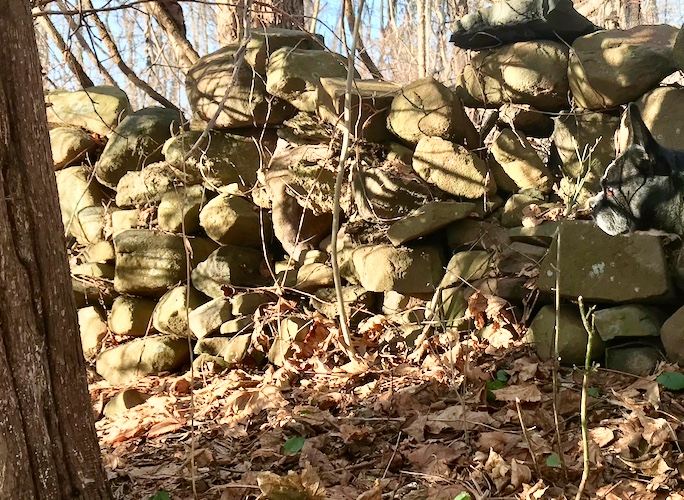
Stone wall, terrier seen in profile at far right. NexGuard, chewables monthly. (PSA: A trusted vet is invaluable in the journey of life with dogs and equines.)

Along the way, there are many events, good places to eat, stories to find.
Montville, The Bond Property; Avalonia Land Conservancy, Inc., $2,340,000. Total area, 669 acres. The Avalonia Land Conservancy seeks to purchase 669 acres of land previously used for sand and gravel extraction. The property lies within the Niantic River watershed. Barnes Reservoir and Bogue Brook Reservoir lie to the north and south of the property respectively and are part of the New London water system. Latimer Brook runs along the western boundary of the property and will allow for trout fishing opportunities. Prior gravel extraction on the property has resulted in multiple states of forest regrowth. The property lies within the Lower Connecticut River New England Cottontail Conservation Focus Area. Flooded quarries, accessible by dirt roads with parking areas, will offer paddling and fishing opportunities. Thirty acres of the property are currently being used to grow feed hay which the conservancy will continue to allow.

From across the Connecticut River in summer, the blue onion dome of the Colt complex, Hartford.
Pomfret, Frankfurter Project; Town of Pomfret, $187,250. Total area, 131 acres. This 131-acre parcel is almost completely surrounded by protected open space and is adjacent to the Airline Trail. The property was logged about 10 years ago and is now an early successional forest. It is part of a wildlife corridor made up of more than 2,000 acres of open space. There are 2 inland wetlands and a pond on the property. Old logging roads on the site will be used for passive recreation. They can be accessed from several points along the airline trail. Access is also available on Wolf Den Road and from the New England Forestry Foundation’s trail system. Bass fishing will be permitted on the property’s pond.
Salisbury, Pope Property; Salisbury Association, $136,500. Total area, 78.99 acres. Acquisition of 79 acres of Wetauwanchu Mountain. The property abuts the Appalachian Trail on U.S. Route 4 in Salisbury and is part of 2,000 acres of undeveloped land. The property is within an aquifer protection zone and protects the headwaters of several brooks including 685 linear feet of Spruce Swamp Brook, a Class AA stream. The water of Spruce Swamp Brook flows into the Salmon Kill which drains into the Housatonic River. Approximately 18 acres of the property contain prime and statewide important farmland soils. The property is located within the Appalachian Trail and the Housatonic River greenways. Important habitat types are on the property and include, dry oak forest, Laurentian-Acadian Meadow/Shrub Swamp, and a Circumneutral Maple/Ash Basin Swamp. Hiking and fishing opportunities will be made available to the public. The Pope Property is close to Torrington (24 miles) and Winsted (25 miles), which are distressed municipalities.
Sharon, D’Alton Property; Sharon Land Trust, $240,000. Total area, 70.37 acres. Located on West Woods Road in Sharon, these 70 acres of undeveloped land consist of core forest, bedrock outcrops, open wetlands, and a ridgeline visible from Connecticut Route 4. The property abuts Skiff Mountain Wildlife Preserve and is part of a 15-mile wildlife corridor. Guinea Brook, a headwater trout production stream that drains to the Housatonic River, is located close to the property. There is a trail system already developed on the site. A pond can be accessed from Westwood 2 Road and will allow fishing. The D’Alton Property is close to Torrington and Winsted, which are classified as distressed communities.
Southington, School Street/Marion Ave.; Town of Southington, $82,600. Total area, 5.5 acres. Acquisition of two separate parcels in a residential area in Southington. A tributary of Judd Brook runs across the parcels from west to east. Three acres of wetlands are found within the two parcels. Within 700 feet of the easternmost parcel is an 8-acre undeveloped wetland area that is adjacent to 170 acres of town owned open space. The town reported potential to secure an addition 7 acres within the corridor. A 1-acre field on the property is suitable for haying. The parcel is approximately 3 miles from downtown Southington.
Stratford, North End Park Acquisition; Town of Stratford, $10,500. Total area, 4.3 acres. Proposal aims to purchase 4-plus acres of open space contiguous to the town-owned North End Park in Stratford. The purpose of the acquisition is to protect 300 linear feet of stream that flows into the park’s pond, and to create a hiking trail for passive recreation. The existing pond offers fishing for largemouth bass and pan fish species. Fishing would be made available to the public in the acquired stream. The property is within the greater Bridgeport urban area and is easily accessible for citizens living in the North End of Stratford.
Washington Depot, Hillside Farm; Steep Rock Association (SRA), $350,000. Total area, 85 acres. SRA aims to preserve 85 acres of open-space farmland and intact core forest. It will use the land to extend its trail system and to permit continued agricultural use. The parcel contains 1,800 feet of frontage on Sprain Brook; a Class A cold-water stream. The site is less than 2 miles from the Audubon Society’s 13,800-acre Important Bird Area. The parcel is part of 450 acres of intact core forest. There are three key habitats of Greatest Conservation Need located on the property. These habitats are Appalachian hemlock northern hardwood forest, laurentian Acadian meadow/shrub swamp/shrub thicket, and circumneutral maple/ash basin swamp. Steep Rock Association plans to create a 1.5-mile hiking trail, and will allow catch and release fly fishing. Thirteen acres are currently being farmed for hay and corn and will continue to be farmed after purchase. It can be accessed by the public from Nettle Hollow Road.
Westbrook, Toby Hill VIII; Town of Westbrook, $315,000. Total area, 146.74 acres. Parcel is part of a 600-acre block of core forest which includes some existing protected lands. It is a mixed coastal hardwood forest and contains oak, hickory, beech, black birches, and red maples. The upper reaches of Trout Brook, a Class A tributary, runs through the center of the property. Native brook trout have been recorded on site. The Connecticut Water Company’s Holbrook well site is located downstream. The property features moderate and steep slopes, glacial erratics, scenic vistas, and a plateau interspersed with wetlands. The property is favorable for passive recreation and is accessible over an unpaved portion of town-owned Toby Hill Road.
Weston, Weston Farms; The Nature Conservancy (TNC), $602,000. Total area, 74.16 acres. TNC aims to purchase 74-plus acres of forest directly adjacent to Devil’s Den Preserve. This is TNC’s largest preserve in Connecticut and is part of 15,300 acres of contiguous forestland with high conservation value. Weston Farms is a mature, mixed hardwood forest that lies within the Saugatuck Central Greenbelt. The parcel lies entirely within the West Branch sub watershed of the Saugatuck River, a Class A stream. A hiking trail will connect to the 20-mile loop trail at Devil’s Den.
Weston, Fromson-Strassler Acquisition; Aspetuck Land Trust, $625,000. Total area, 85.86 acres. This property is adjacent to the Aspetuck Land Trust’s 118 acre Honey Hill Preserve. The site is part of a forest block assemblage of more than 350 acres. There are 5 wetlands on the property covering 22 acres. The wetlands on the northern end of the property form the headwaters of the West branch of the Saugatuck River. American eel and Black-nosed dace have been collected in the West branch. Migratory bird species and amphibians inhabit the site. A trail head and parking area at the end of Upper Parish Drive will create a link to the area’s regional trail system.
Wilton, 183 Ridgefield Road; Wilton Land Conservation Trust, $707,000. Total area, 13.4 acres. Proposal by the Wilton Land Conservation Trust (WLCT) to protect 13 acres of open field habitat. The property runs parallel with Ridgefield Road and is about 1 mile outside the center of Wilton. There are 12 acres of Prime and Statewide Important Farmland Soils on the site. The northern 2 acres of the property is a forested wetland habitat. The open fields are in the center of the Wilton pollinator pathway. A drumlin landform is located on the site. The WLCT plans to create a trail that will be accessible for people with mobility challenges, as well as a wheel chair accessible gravel parking area. The site will have educational kiosks and opportunities for school groups to learn about that state’s agricultural history. This property is located within lower Fairfield County.
Note: While out and about with your dogs, be aware of Connecticut’s leash laws, as well ordinances in state and local parks, woodlands. And please clean up after your pet(s) and properly dispose of the bagged waste. Also, do tick checks after your outing, For tips and precautions, here is a link to the official Connecticut government site and the incredible resources of The Connecticut Agricultural Experiment Station (CAES). “As a public service, there is no fee for (CAES) tick identification and/or testing. Municipalities or local health departments/districts may charge a nominal fee for handling and mailing.” Tick testing is available at UConn, linked here to a page with more information. Tick Encounter at the University of Rhode Island adds even more dimension to life with ticks and during climate-shifting changes in our environment.