
Climate Resiliency Leadership In CT, 24 Communities Add 2,466 Acres
“Some are born in their place, some find it, some realize after long searching that the place they left is the one they have been searching for.” — Wallace Stegner
Thaw, freeze, warm as April, then the weather will turn. This is Connecticut, a state with so many facets and landscapes from shoreline to ancient ridgelines, small towns and cities, estuaries, rivers, streams, backroads, hamlets and groves. A home of choice for many who can reside anywhere on the planet. Great libraries, universities, deep resources for field trips, thinking and doing. So let’s go look around.
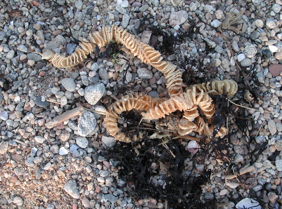
Along the shoreline, natural treasures can be found. Outdoor excursions will make memories that last a lifetime. New grants will add to the open space and watershed of the state. Climate change resiliency factors in to this stewardship leadership.
Parks, open spaces, nature centers, forests, shared trails — all serve as shock absorbers for the frenetic pace of today’s world with more people, increased impatience. An almost ever-present handheld computing device connects the real world with a digital universe. But for those who have been underneath an utterly dark sky with stars and Milky Way overhead and glow worms beneath your steps in sweet-scented fields — there’s nothing like real-life experiences. (But a smartphone is a valuable resource for imaging, news, access to science and thought leaders, business. It’s a storytelling machine.)
For those who live in or near Connecticut, there are countless options to walk, hike, paddle, ride (where horses and/or bicycles are permitted), stroll, stand still and marvel. And sometimes, to take a drive and sit, especially important for those with very young or older family members with a more limited range of mobility. Life is lived in chapters, and there can be great joy in re-visiting favorite places with people you love. You never know what you may see or find on an outing.
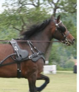
Seen on a warm day walk in a state park – a driving competition, interesting and wonderful to watch.
Now there will be even more resources for making memories and being outdoors. (Next up, a walk-tour around Hartford and New Haven.)

Castle Craig.
Governor Ned Lamont recently announced that the State of Connecticut is awarding $9.1 million to support grants for 24 communities in the purchase of 2,466 acres of land that will be designated as open space. The grants are authorized under the state’s Open Space and Watershed Land Acquisition Program, which is administered by the Connecticut Department of Energy and Environmental Protection (DEEP) and assists local governments, land trusts, and water companies in purchasing land to protect open space.
Intended to “protect wildlife habitats, offer recreational opportunities, and serve as a buffer and adaptation to climate change,” recipient projects are required to supplement the state funding with matching funds or other grants, and the land being purchased must be protected by a conservation and public recreation easement that will ensure the property is forever protected for public use and enjoyment.
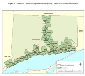
Coast and estuaries, Connecticut 2015 report linked to this image.
“Open space is vital to environmental protection and a bright economic future for our state,” Governor Lamont said. “This program is an important component of preserving some of our state’s best and most beautiful land, and by partnering with our municipalities and nonprofits we can ensure that these valuable resources are preserved in perpetuity for generations to come.”
“Governor Lamont’s administration has prioritized initiatives that mitigate and adapt to the effects of climate change, while ensuring that DEEP implements policies that better preserve our air, water, and natural resources,” DEEP Commissioner Katie S. Dykes said. “This open space grant round represents an important investment and continued partnership with land trusts, our towns and cities, water companies, and conservation-minded citizens in preserving open space that makes progress toward climate response and provides greater opportunities for people to connect to our natural lands.”
The announced projects in an official press releae bring the total land in Connecticut designated as state or local open space to 500,000 acres – approximately two-thirds of the way toward the state’s goal of having 673,210 acres designated as open space.
In December 2019, the State Bond Commission, which is chaired by Governor Lamont, approved an allocation of $5 million to fund the program.
The current round of grants are being awarded to the following projects: Open Space and Watershed Land Acquisition Grant Awards
Bristol and Burlington, Pigeon Hill Property; grant of $850,800. Total area, 63.9 acres. Collaborative project between the City of Bristol and the Environmental Learning Center. Upon project completion, the City of Bristol will own 35.6 acres located in Bristol and the Environmental Learning Centers of Connecticut will own 28.3 acres located in Burlington. The property is made up of a 45-acre mature, mixed hardwood forest, 9 acres of fields, a 0.6-acre pond, and a glacial esker the runs along the western edge of the property. A 304-acre Aquifer Protection Area, owned by the City of New Britain, is located less than 600 feet past the property’s southern boundary. Directly west of the property is The Barnes Nature Center and Seymour Park. Roughly 15 acres of the property are made up of statewide important soils.
Clinton, Lot #30 West Road; $7,000, 5.2 acres. The town of Clinton seeks to purchase Lot #30 on West Road, a 5-plus acre property that falls within a proposed greenway location and is directly adjacent to the town beach. Located between the coastline and the Hammock River, it functions as a coastal wetland habitat and provides flood protection for residential properties to the south. The site is less than 1 mile from the town’s commercial center. This area will be accessed along a proposed coastline trail.
Cornwall, Red Mountain (Gallucci) Preserve. Sponsor, Cornwall Conservation Trust, Inc.; grant $225,000. Total area 72.5 acres. Acquisition of 72 acres of core forest on Johnson Road in Cornwall. The property is almost completely surrounded by protected land and makes up a forest block of 2,350 acres. The headwater stream of Birdseye Brook is on the property and provides 2,500 linear feet of headwater stream for the Housatonic River. The preserve is a dry oak forest. The property is accessible from Johnson Road, which is just off Connecticut Routes 4 and 43. A section of the Connecticut Blue-Blazed Hiking Trail System runs along the northern boundary of the property. The Cornwall Conservation Trust will construct a public trail to Birdseye Brook which will connect to the Mohawk Trail. The cities of Torrington and Winsted, which are distressed communities, are within 15 miles of the preserve.
East Lyme, Pattagansett River Watershed Preserve. Sponsor, East Lyme Land Trust, grant of $179,200. Total area 38.7 acres. Property is surrounded on three sides by more than 3,000 acres of protected forest. A wetland on the easterly boundary forms the headwaters of the Pattagansett Watershed, which supplies half of the drinking water for the Town of East Lyme. Some 15 acres are in early successional forest providing habitat for the New England cottontail. Other features of the sight include wetlands, vernal pools, and rock ledges. There is potential to create trails that connect to the 14-mile Goodwin Trail.
East Lyme & Montville, Nehantic Nature Preserve; sponsor, Woodsman Land Trust Inc., $560,000 grant. Total Area: 320 acres. Proposal is for a large tract of forestland on the Montville/East Lyme border. The site is less than half a mile from the Holmes Road entrance to the Nehantic State Forest. This property is located in the Latimer Brook watershed which flows into the Niantic River. Important features of the site include ledge outcrops, inland wetlands, and two ridgelines. Mixed hardwoods such as black oak and shagbark hickory grow here. Red maple, black gum, and American elm grow in the wetlands on site. An Eversource powerline right-of-way creates borders of young forest growth. The site is located within multiple Natural Diversity Database areas. The Woodsmen Land Trust plans to create a hiking trail that will connect to the Nehantic State Forest trails.
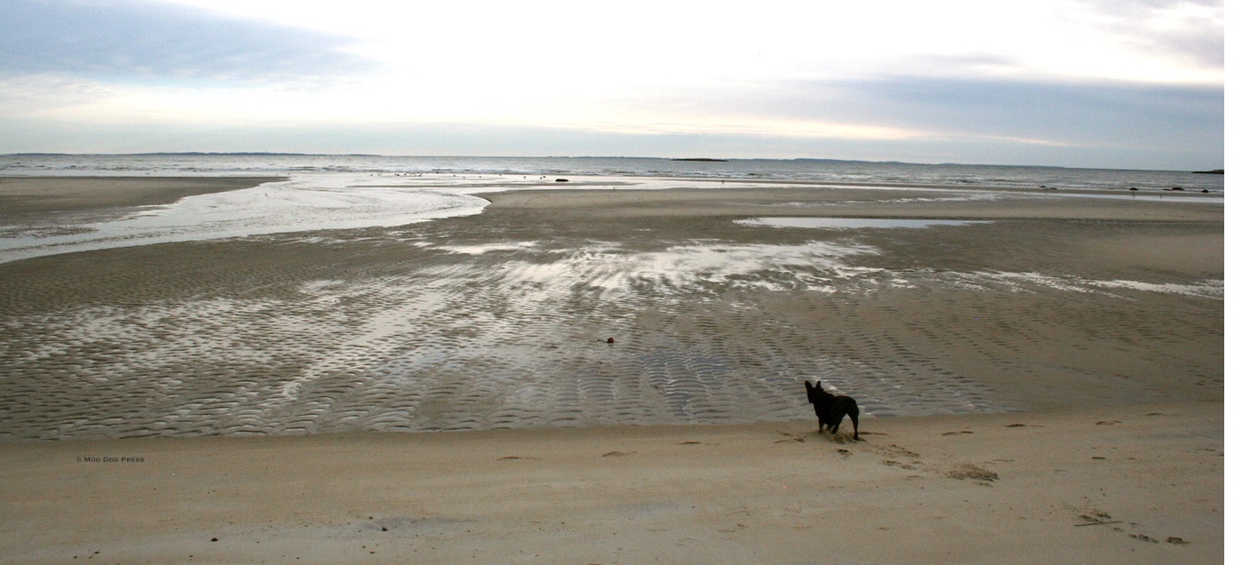
Time and space at the edge of land, sea. sky.
Ellington, Wraight Property; sponsor, Northern Connecticut Land Trust, $132,500 grant. Total Area: 118.4 acres. Large tract of undeveloped land is located next to the Shenipsit State Forest. The property is primarily forested and has 3.7 acres of hayfields near Webster Road. Charters Brook runs north to south through the center of the property and into Shenipsit Lake Reservoir which provides drinking water to the surrounding towns. The abandoned portion of Porter Road will be converted into a 2-mile trail and will provide a link to the Soapstone Loop C trail, the White Dot trail, and the Shenipsit Blue hiking trails. The site can be accessed along 1,625 feet of frontage on Webster Road.
Groton, Sheep Farm South; sponsor, Groton Open Space Association (GOSA), $600,000 grant. Total area: 103.49 acres. GOSA seeks to secure 100 acres of open space to add to their recently secured Sheep Farm property. The acquisition of this second parcel would provide a link between Groton’s east-west X-Town Trail and north-south greenbelt. More than 1,700 acres of open space are adjacent to the property. A unique vernal pool system connects to Fort Hill Brook. Fort Hill Brook flows through the property into Mumford Cove, a rehabilitated coastal area. Access to the property will be available from Fort Hill Road and Flanders Road. A trail will be built to connect the Flanders Road entrance to trails on the initial Sheep Farm property.
Hamden and Bethany, Hendrickson Property Acquisition; sponsor South Central Regional Water Authority, $19,600. Total area: 7.53 acres. The South Central Connecticut Regional Water Authority (RWA) aims to purchase 5.4 acres of Class I and 1.6 acres of Class II land. The property will connect to 164 acres of RWA land that abuts the property. Two streams on the property drain into Lake Watrous, a public water supply reservoir. The parcel is part of the West Rock Ridge and harbors species of special concern. Ninety percent of the property is made up of prime farmland soils. The RWA will allow for passive recreation, timber and cord wood harvesting, and environmental education and research. The 19-mile Quinnipiac Trail crosses the property.
Hamden, DePodesta property; sponsor is South Central Connecticut Regional Water Authority, $25,000. Total area: 14 acres. The RWA seeks to acquire 14 acres behind Forest Street in Hamden. Upon purchase, 9 acres will be Class I and 5 acres will be Class II land. There are two unnamed streams on site that flow into Lake Whitney, a public water supply reservoir. More than half of the property contains designated prime farmland soils or additional statewide important farmland soils. The Farmington Canal Trail abuts the property to the west. The RWA will evaluate the property to determine if additional recreational uses are permitted. The property is located in an area with extensive development. Downtown New Haven is 5 miles from the property and the “Centerville” section of Hamden is located here.
Ledyard, Maynard Farm; Avalonia Land Conservancy; $108,000. Total area, 99.82 acres. Maynard Farm borders Avery Preserve and would almost double its size. There are 30 acres of wetlands on the site which flow into Billings-Avery Brook and then into Morgan Reservoir. This reservoir provides drinking water for the towns of Groton, Ledyard, and Preston. The property is part of one of the largest intact coastal forests in Connecticut. The site is part of a proposed greenway/wildlife corridor in Ledyard. Habitats within the property include a red maple swamp and an acidic Atlantic white cedar swamp. A mixed hardwood forest and former pasture create habitat for an array of plant and animal species. Access to the property from 32 Avery Hill Road will offer passive recreation on 1.37 miles of trail. A link will be created to the trails on Avery Preserve. Maynard Farm is less than 10 miles from Groton, Norwich, and New London.
Madison, Dowd Hollow Preserve; Madison Land Conservation Trust, Inc., $480,000. Total area, 144.47 acres. Property abuts land held by the South Central Connecticut Regional Water Authority (RWA) and lies within the East River Watershed. Dowd Hollow Brook bisects the property flowing from its headwaters in the RWA’s White Cedar Swamp and eventually discharging into the Long Island Sound. The parcel hosts numerous habitats including vernal pools, open fields, shrub meadows, forested wetlands, and a cranberry bog. A large portion of the property lies within a Natural Diversity Database Area. Acquisition of this property will protect one of the largest forested tracts in southern Connecticut. The MLCT will create a new public parking area and new hiking trails linking to RWA’s Genesee Recreation Area and Ironwoods Preserve.

Exploring in Manchester.
Manchester, Lombardo Farm; Manchester Land Trust, $300,000. Total area, 102 acres. Proposal from the Manchester Land Trust will add 102 acres to their Bush Hill Preserve. A part of this preserve known as the Botti Farm, was purchased with the help of a 2016 OSWA grant. Lombardo Farm is completely surrounded by open space and would allow for passive recreation with the construction of trails connecting to Bush Hill Preserve. Access will be available along the property’s 2,000 feet of frontage on Hillstown Road. A mature forest and a small spring-fed pond provide wildlife habitat. An open meadow provides habitat for migrating birds and pollinator species. The towns of Manchester, East Hartford, and Glastonbury are within a short distance of the site.

Focus. CB/MDP
Story continues on next page, linked here.