
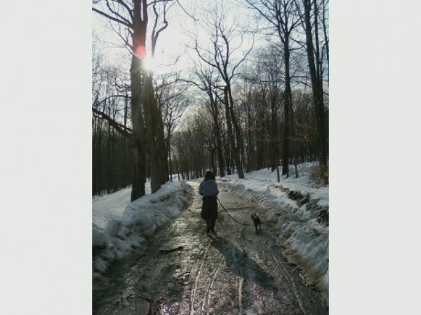
Old Pasture Winter Walk. Mantids. Bones. Trackways
“Through central Connecticut and Massachusetts, Interstate 91 runs past a series of long, prominent ridges. These elongated mountains with their dramatic rust-colored cliffs have long caught the eye of residents and visitors. Adrian Block, the first European to sail Long Island Sound and see the Connecticut coastline, named one of his anchorages Rodenberg (red mountain) for the great red cliffs that dominated the landscape. That anchorage is now the port of New Haven, and the mountains that so impressed Adrian Block are East Rock and West Rock,” according to a pretty fascinating Wesleyan University brochure on the geology and importance of traprock ridges. (Note: Since this story was published, the link to the university’s web site may no longer work. Try this updated link to a PDF instead.)
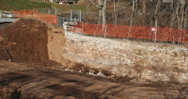
Speaking of interesting geological sites and finds, when the waters of Lake Beseck in Middlefield were lowered to allow for repairs of the dam that may be viewed off King Road (a dead-end that skirts the lake’s borders), the shape of all emerged. The old (and somewhat ramshackle) ice houses that once overlooked the water are long gone; a new housing project on the ridge is now the suburban landscape. But. The 60-foot dam originally constructed in 1848 at a “narrowed neck of a ravine of this area then known as Wildcat Swamp” was visible. The original construction cost $1,000. The purpose was to provide waterpower for industry – the 10 factories located downstream, known collectively as the Middlefield Reservoir Company.
The curved face of the dam is built of brownstone quarried locally on Powder Hill Road. The know-how of man with leverage and oxen to haul slabs into place down hill also led to the discovery of “giant bird” footprints. The best of those stone tracks were kept aside and use to top off the dam. Two decades later, more stones were added to increase the dam to 80 feet in height, so somewhere in the layers is the original capstone man-made pattern of a dinosaur trail.
In 2014, the inspection and engineering work to ensure the safety of the dam goes forward directed by Fuss & O’Neill. “In general the permittee is authorized to construct a concrete cut-off wall along the upstream face of dam and spillway; abandon the existing low level outlet by removing the access bridge, removing a portion of the existing chamber, and filling the remaining structure & pipe with concrete; and construct a new gate chamber which would contain the new low level outlet in the vicinity of the right spillway abutment.” The PDF schematics that were online show the location of a sinkhole and an arrow that points to the original capstone level in the dam.
The bowed face of the dam is built of brownstone quarried locally on Powder Hill Road. The know-how of man, leverage and oxen to haul slabs into place is how the slabs were moved into place down hill – and during the process the footprints of “giant birds” were found. The best of those stone tracks were kept aside and use to top off the dam. Two decades later, more stones were added to increase the dam to 80 feet in height, so somewhere in the layers is the original man-made pattern of those dinosaur footprints.
To see hordes of tiny praying mantises hatch out then stream out of an old well house is something long remembered. On a recent winter walk in old pasture a frozen froth of a blob on a dry stem brought back that parade of teeny-tiny marching mantids.  Tidewater Virginia has a high water table (try digging fence post holes – the water is literally a shovel full of earth away) and there are no cellars. Winters were interesting because heat tape and a dangling light bulb had to be placed to prevent pipes from freezing. Much was learned and observed in those days, now decades in the past. The lessons of farm, field, mechanics and land stay.
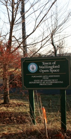
A sign located off Powder Hill Road led to a new exploration walk to a former hay field now filled with interlocking sprawls of briars (most likely blackberries). Surrounded by new development, the 53-acre open space property is owned by the town of Wallingford and is permanently protected, purchased in 2001 from the Bugai family.
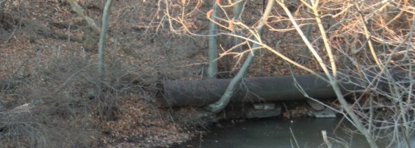
 There’s limited parking near the sign and a gate for access by walkers to head downhill past a tunnel-like stand of bamboo ( an invasive species) then across a little stream. Mote the ice formations and use caution as the stepping stones were under water due to recent rains and snow melt.
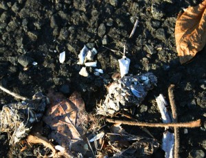
Owl pellet with small bones in evidence.
The Metacomet Ridge System is a voluntary agreement of towns and cities to preserve the traprock ridges that extend from the Massachusetts border to the Long Island Sound, “one of the state’s most familiar geologic features.” The parcel’s acquisition price was $344,500, not bad for 53 acres ($131,000 from the Connecticut Department of Environmental Protection’s Open Space and Watershed Land Acquisition Grant; town, $213,500).